The historical map codes related to our paper /Automatic extraction of forests from historical maps based on unsupervised classification in the cielab color space/ is now available in QGIS through the experimental plugins. The objectives of the paper were to propose a processing chain to classify the forest areas in old digital maps.
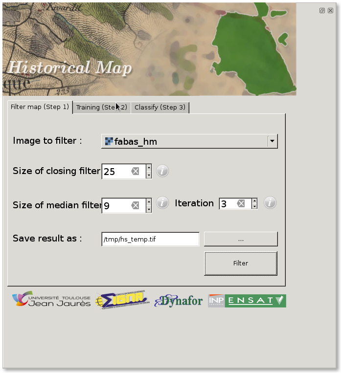
To install the plugin, just activate the experimental plugin and search for Historical Map. Once installed you should get something like this:
The processing chain is a little bit simplified from the article:
- Process data with morphological and rank filter,
- Train a classifier model,
- Predict the whole image and do some spatial processing.
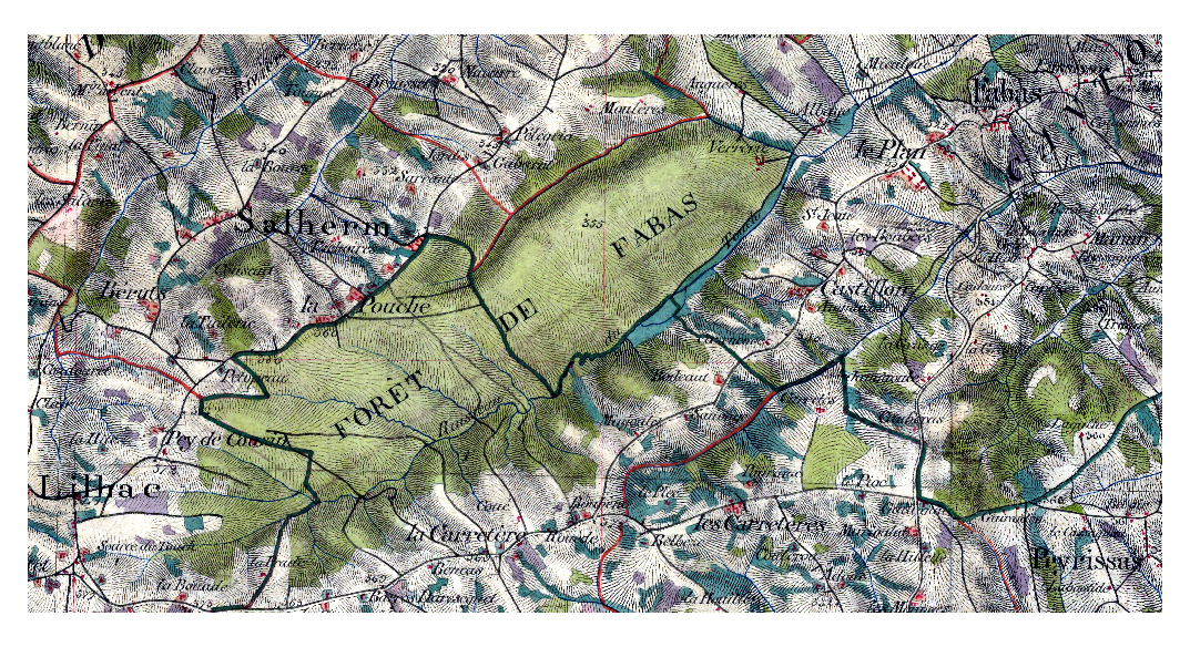
Let’s see how to do that in pratice. First we open the data with QGIS:
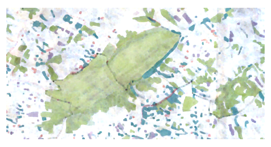
We can see the the level lines and the names of the areas that would deteriorate the final classification results, by increasing the heterogeneity of the Forest class (higher inner-class variability). To reduce this effect, it is proposed in the article to filter the image using a rank filter (closing and median). So let’s do it with the plugin: filter the image with a morphological closing of size 25 and a median of size 9 with three iterations. We get the following results, where we can see that forest areas are much more homogeneous:
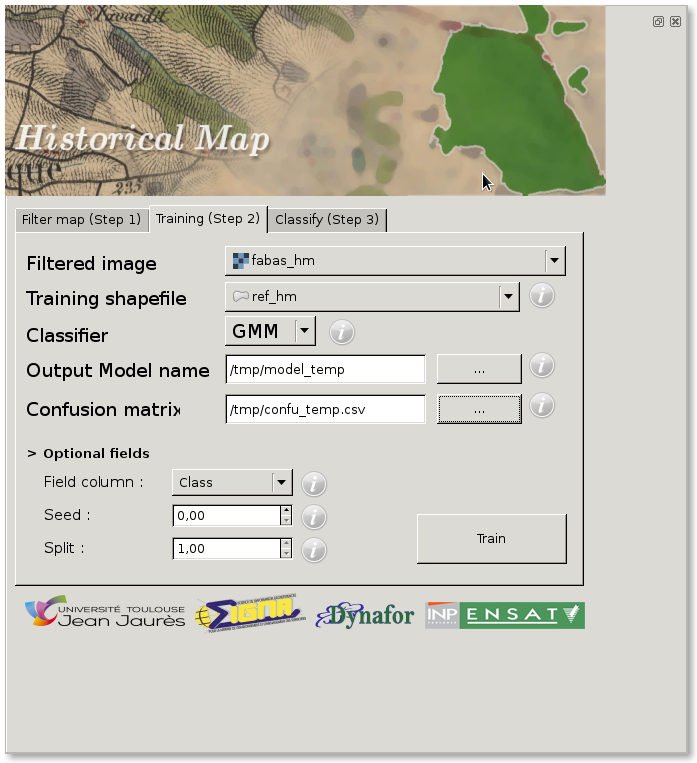
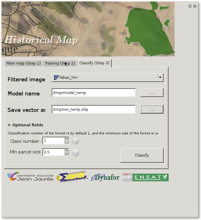
Now it is possible to learn the classification model, again directly from the plugin. Here we are going to use the conventional Gaussian Mixture Model:
Then we can classify the whole image, convert it to a vector shp file and remove forests that are too small.
The final result is :
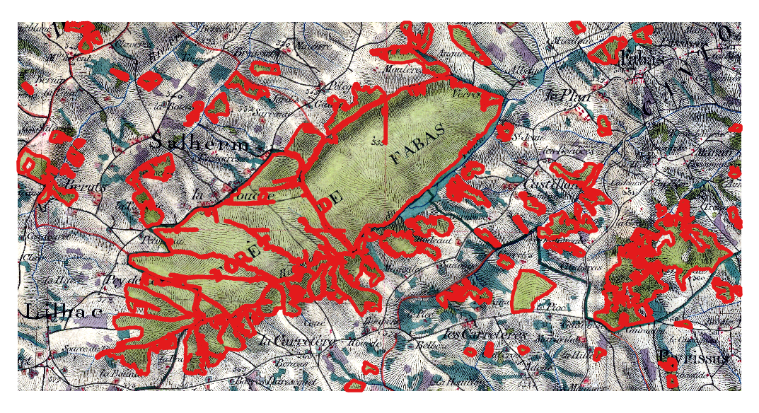
Not that bad, isn’t it ? Ok we can filter a little bit at the beginning ;)
Enjoy and let us know if you need additional information.
Thanks to Nicolas Karasiak and Antoine Lomellini, students from the Master SIGMA for the implementation !
Also thanks to Hugo Thierry for the spell-check ;)
Comments
comments powered by Disqus